Monday, January 16, 2012

Yelcho Lake, River and Glacier


Yelcho River

One of the most scenic places in southern Chile is the area around Lago Yelcho in central Patagonia. The gravel road was built after 1976 and is just now being widened and paved, a job that will last a few more years. The area draws fly fishermen and other tourists during the season from November to May. The single track gravel road has the grand name of Carretera Austral. Carretera means highway.


This substantial bridge over the Yelcho River was a joint project of the Chilean and German governments.


Yelcho Lake. I joined a group of eight people for a 3-hour hike up to the Yelcho Glacier. We were quite an international group of French, British, Chileans and me. It was a beautiful and warm day. But it was a forest walk along the river and the sun was not in the right place for good photos.

Friday, January 13, 2012

Comau fjord


A new route has opened just this season in northern Patagonia and I couldn't resist trying it. I bought a bus ticket and left Puerto Montt for the 10-hour trip by gravel road and by water south to Chaitén. It would be much easier to take the 8-hour boat directly, but this route appealed to me. The bus departed Puerto Montt at 10am. After the first 90 minutes by road along the Gulf of Reloncaví, we arrive at La Arena where our bus joins transport trucks, cars and motorcycles for the 30-minute crossing of the entrance to Reloncaví fjord.


Our boat arrives at the ramp.


Passing Reloncaví fjord, Yates volcano in background. I was on the other (eastern) side of this volcano one week ago in Cochamó.


We arrive at the town of Hornopirén at the northern tip of Comau fjord. There is no land road connecting with central Patagonia, but there are three choices of sea travel south.  I chose the new route that passes through this fjord. We leave at 2pm.


Fishing village of Cholgo. Notice the water color indicating a glacial source.


Our boat traveling south on Comau fjord. I was one of 23 passengers on the bus for the 10-hour trip from Puerto Montt to Chaitén. About half of the passengers were young men working on a construction  project, building a new fishing lodge on Yelcho Lake in central Patagonia. The boat holds about 15 vehicles. It's a great day for a suntan(burn).


Entrance to Quintupeo fjord. In 1915 a German warship was evading the English navy and entered this small fjord to make some repairs. It is about 3 miles long and only one half mile wide. The narrow entrance to the fjord allows for a sneaky hideout. When the English were about to discover them, the Germans left a decoy of a large raft with lights and fled the area in their ship. Click here for photos from my 2011 visit to the fjord.


At 4pm we pass by Cahuelmo fjord. We continue traveling south along the Comau. The weather is warm and clear, which does occur in this rainy part of the world.


Passing the northbound boat. We soon arrive at the ramp at Leptepu for the 6-mile land crossing to the next fjord.


Our third and final boat for the day.


Just before docking at Caleta Gonzalo we get a great view of Michimahuida volcano. We are entering the huge southern portion of Pumalín Park that was established by the north American Doug Tomkins. His plan was to purchase huge tracts of land as a nature reserve and then donate it back to the Chilean government. Many Chileans believe he has ulterior motives. Much of the distrust is because his land reaches from the Argentine border to the Pacific Ocean. From here our bus travels the final 58 kilometers to leave us in the town of Chaitén. Click here for more photos of this town destroyed by a volcano in 2008.


Chaitén

Wednesday, January 11, 2012

Angelmó


Angelmó is a small community at the west end of Puerto Montt where there is a lot of activity relating to boats and ships and where fish and shellfish are delivered from surrounding areas. It has always been a colorful place that draws many tourists. I often enjoy taking a walk around the market and waterfront. Here are people coming and going across the narrow channel to Tenglo Island. Calbuco volcano is in the background, less than 20 miles to the east. In 1893 there were several prolonged eruptions that caused the volcano to collapse, changing the course of rivers. The most recent eruption was in 1996.


The Navimag ship arrived from the south today. It travels through the spectacular Patagonia channels to Puerto Natales, near the Straits of Magellan, carrying trucks, cars, and people.


Several Monicas are lashed together, having completed their day of tourist excursions to nearby islands. To the left is the two-tiered "cocinerías," tiny dining rooms that serve fresh fish and shellfish. The market is nearby. Navimag is in the background


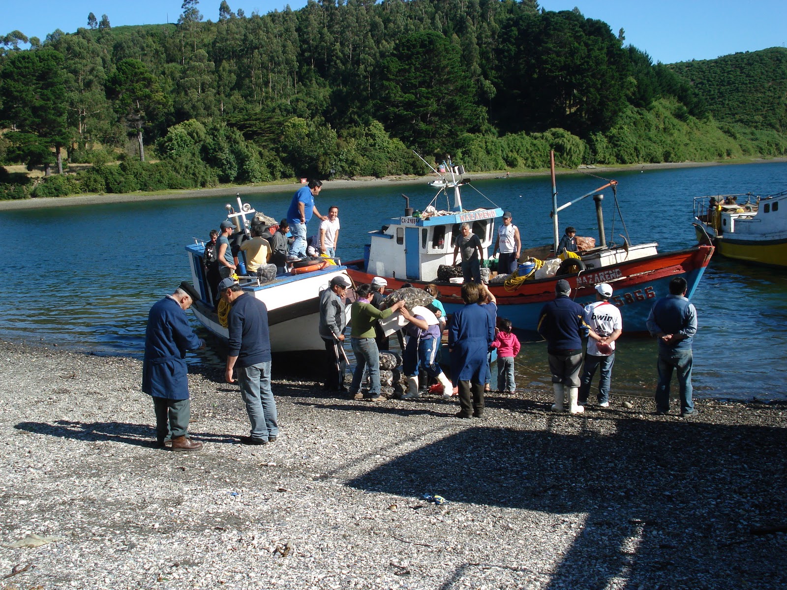
At about 6pm there was a flurry of activity as people await the daily delivery of products from the area. These boats have sacks of mussels and clams. The people on shore are haggling for their share to sell in the market. There is a lot of joking, laughter, and arguments. Most have cash in hand, vying for the next sack of clams off the boat.


The delivery draws quite a crowd of onlookers. The products are delivered to the market below and one can order them at the tables in the dining rooms above, each one with a different owner. I couldn't resist, so took a seat at the window on the far right for a big plate of clams with onion, parsley and lemon juice. A glass of house wine helps with digestion.


There is only one way to offload the sacks, on people's backs.