 On Monday, August 30, after navigating upriver on the Marañon River in eastern Peru, the 33-meter long Ayapua, with 19 Earthwatch volunteers, several Peruvian biologists, crew and assorted personnel, arrives at the mouth of the Samiria River. The Marañon is one of the major tributaries of the Amazon River. We are just above its confluence with the Ucayali River, where the Amazon proper begins, though it is sometime called the Salimões.
  The water level in this Peruvian area of the upper Amazon basin is at a 40-year low, so we cannot enter the Samiria where we had hoped. We will still be able to conduct field research with small auxiliary boats. We traveled upriver for two days with a flotilla of seven small boats tied to the Ayapua. We will stay on the river for twelve days. Accommodations are very comfortable and the crew is friendly and very helpful. The food is wonderful. We eat lots of river fish and chicken with rice and fried bananas with delicious sauces. It's different every day.
 A crewmember is securing our bow to a tree on the Marañon. From October to December the river level will rise and flood the lowland forest, known as várzea. These trees have high water marks at about 2-3 meters.
  The shore of the Marañon shows signs of low water near our boat. We must navigate around submerged trees and snags every day to get to our study areas. The expert boatmen can do this even in the dark of night when we search for caiman.
 Morning banana delivery at the Ayapua
 Resident tarantula on the Ayapua
 Our job is to help the resident biologists collect and record data about wildlife populations in the Pacaya-Samiria National Reserve. Other volunteer groups have been doing the same throughout the year and more will follow us. Biologist Tula Fang accompanies us while volunteer Sandra records the 58 pink and grey river dolphins we counted this day.
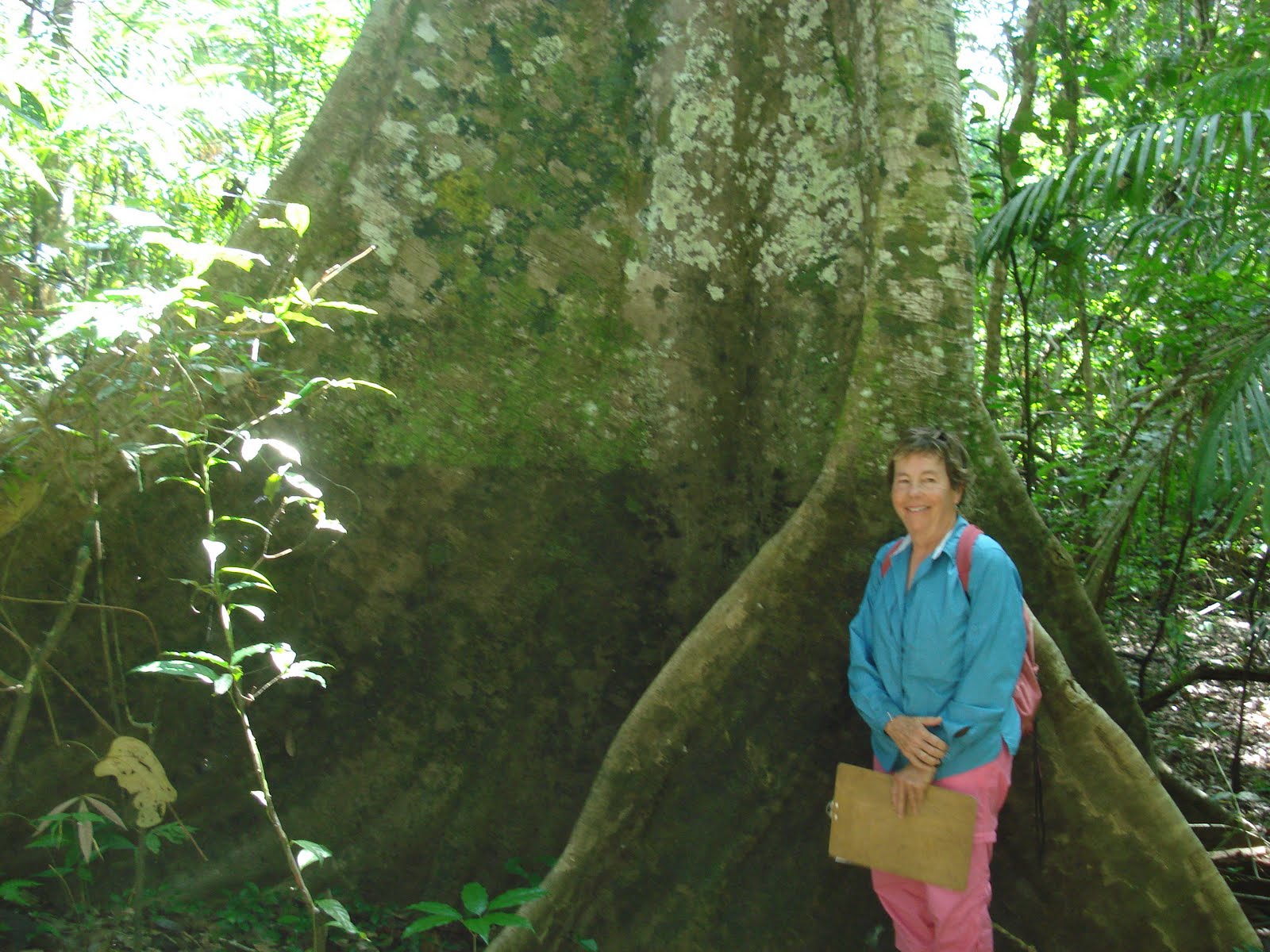 Sandy poses at the base of a “flying buttress” tree. These bizarre roots can occupy a space of 30 feet wide, although the trunk might be only three feet in diameter. This was on the shorter, 4-kilometer transect.
 Few flowers are in bloom in the forest right now, so this was a welcome sight. Of course, the best photo opportunities were lost as they were so fleeting: colorful yellow, orange, blue, or black butterflies that flutter closely by but are gone after 3 or 4 seconds; a flock of 20 brightly colored macaws that flush from a tree top; the graceful and playful movement of dolphins that surface momentarily and grunt only a few feet from the boat; a tamarin monkey gliding through the jungle canopy, almost indistinguishable from the leaves and tree limbs. These are continual sightings throughout the day, and bring great pleasure, if not good photos.
Our guide Alfredo poses with three happy campers, Kim, Tessa and Tom.
 Alfredo and I emerge from the forest after a 6-kilometer trek where he spotted families of different species of monkeys. I later entered the data into the database that reflected 101 animals counted that day on our trek in the jungle. As he watched the treetops, Rose and I watched where we placed our feet so we would not trip on a vine and fall or step on a snake. There were two 3-foot long snakes on the trail.


