Created in 2005, Tantauco Park comprises almost 300,000 acres (456 square miles) on the southern tip of Chiloé Island. The island itself is 118miles long from north to south and averages 34-40 miles in width. So the park is a large presence here. It is a popular ecotourism destination, containing two campgrounds and 93 miles of hiking trails. Rainfall averages 98 inches per year.
The land was purchased by Sebastián Piñera, current
president of Chile, as a private nature preserve open to the public. There is
some controversy regarding the park, which is considered to be on ancestral lands of the
indigenous Huilliche (southern Mapuche) people.
The northern sector of the park is accessible by road from
Quellón at the southern terminus of the Panamerican Highway, where trekkers
enter to hike the 5-day trail south to the park headquarters on the very tip of
the island. This area is accessible only by sea via a challenging 3-hour
crossing by speedboat. The headquarters is located in the fishing village Inío (pop. 140), with
a considerable infrastructure. The new park has an interesting role
in the community. It provides many needed services while the local people
provide labor for the park and its visitors. A veterinary service is provided for pets in the village. As a concern for native wildlife, all female dogs have been spayed and most males neutered.
Administration building
Medical clinic
School
There are no cars or roads here, just fishing boats and
oxen. The happy expression on these faces is typical of this unique place.
Everyone here seems happy, due to the availability of work and natural
resources.
The park has built wooden sidewalks around the headquarters to protect the
fragile ecosystem.
The park guesthouse. My room is on the second floor. A
kitchen and sitting area are on the first floor.
The only tourists this week were Veronica, Phil and me. Señora Enofra (front, right) served us breakfast and maintains the guesthouse, a lovely facility with comfy beds.
This greenhouse provides delicious organic vegetables to visitors and park staff.
Surrounding the greenhouse are more vegetables, herbs and flowers. I stop by each day after dinner to choose the herbs I will have in my tea.
Seedlings are cultivated for a large reforestation project. There are areas nearby where trees were inundated and drowned by the 1960 earthquake. That quake is the largest ever recorded and struck near Valdivia, further north. It registered 9.5 on the Richter scale.
These trees will grow to hundreds of feet tall.
Henry is our guide for a 4-hour hike in the mountains above Inío.
This lizard takes on the colors of the ferns.
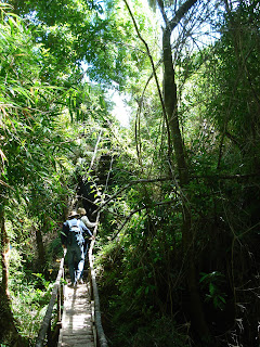
Sturdy stairs and bridges mark the forest trail.
This cluster of caterpillars on a tree trunk are interesting to watch but not safe to touch.
The forest around Inío has many species of trees and shrubs.
Alas, it's time to leave this enchanting place.


No comments:
Post a Comment